|
|
|
Page 2
|
INVASION OF THE ALIENS
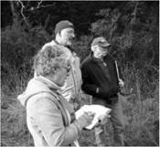
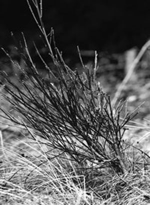
Don’t look now, but the aliens have landed! Actually some of them landed 150 years ago. I’m speaking, of course, about invasive plants. Some of us know all of them, most of us know some of them, and I suppose there are a few folks who are just blithely ignorant of their existence. This is one of those instances where ignorance is not bliss. Gabriola’s list of top ‘invasives’ includes: Scotch broom, Japanese knotweed, Himalayan blackberry (at least they are good to eat), daphne laurel, hogweed, vinca major and minor, and English ivy and holly. In February, biologist Pamela Wesley, coordinator of the Invasive Plant Council of BC, accompanied GaLTT members to look at the invasive plants at Drumbeg Provincial Park. Scotch broom is probably the most rampant. Like most invasives it doesn’t care how poor or dry the soil is; it can thrive almost anywhere and has no natural predators. And, its seeds can lay dormant in the soil for up to 80 years. Scotch broom is responsible for almost destroying the Garry oak meadow at Drumbeg Provincial Park. The meadows continued existence is largely due to a group of private individuals, and GaLTT members, who regularly go on broom-bashing expeditions.
Several of the invasives are very dangerous: hogweed sap can burn skin badly and even cause permanent blindness if you get it in your eyes; daphne, if in an enclosed space gives off fumes that cause breathing difficulties for sensitive people; and broom, if burned, can exacerbate heart problems. For more information on invasive plants, visit www.invasiveplantcouncilbc.ca and learn effective strategies for long-term management.
This year GaLTT is hoping to work with BC Parks to get a handle on the broom, hog- weed, daphne and vinca problems at Drumbeg. We will use the least intrusive mechanical methods to remove the plants, including Extractigators, when the soil is moist, and will cut below the top two lateral roots when the soil is dry. We are confident that over a 20-year period — that is not a typo, it will take at least that long to exhaust the seed bank — we will be able to eliminate broom from the park. However if broom is left to grow, flower and disperse seed on private land, provincial and federal crown land, and road allowances, our efforts will have been wasted.
|
Scotch broom

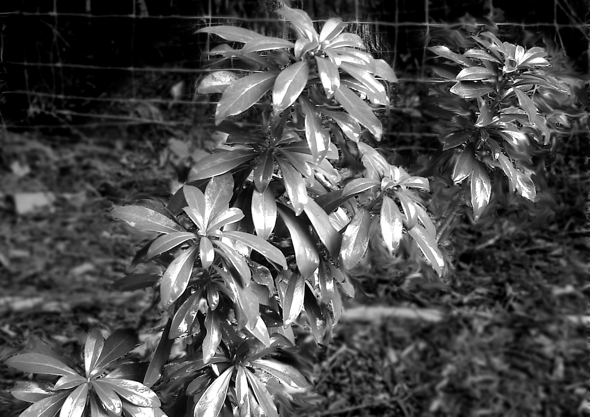
Daphne Laurel
We need a concerted, island-wide, sustained effort to eliminate broom. GaLTT will be considering how best to accomplish this over the next year. In the meanwhile, you can help by simply pulling out, or cutting down, any broom on your property or on the road allowance abutting your property.
When disposing of broom, remember that in addition to creating hazardous fumes when burned, broom is phytotoxic – it kills what is underneath it. So you might try laying it on a patch of weeds you want to get rid of but don’t pile it on anything you want to continue to grow. When dealing with a large infestation, take the following approach. Start with areas with young infestations and work from youngest to oldest plants. Use 10 m buffers to isolate these areas from the heavily infested areas. Once you have removed all the young, more easily removeable plants, then you should start on the older, established areas. GaLTT has six Extractigators for lending to members; just e-mail us at info@galtt.ca and we will hook you up. These clever tools make easy work of even large plants. Now, where did I put my ray gun?!?

GaLTT members at Drumbeg Park with biologist Pamela Wesley (right).
|

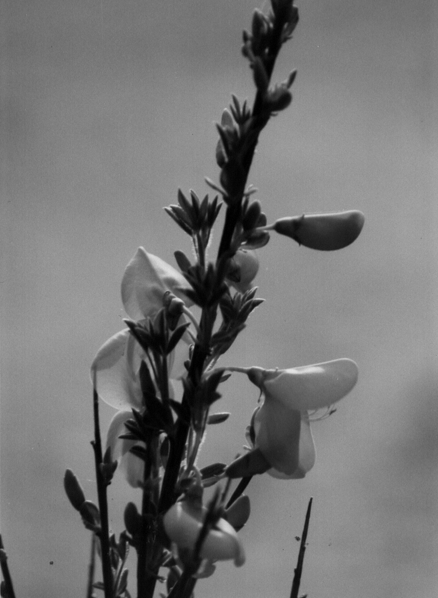
Scotch Broom in bloom
Himalayan Blackberry
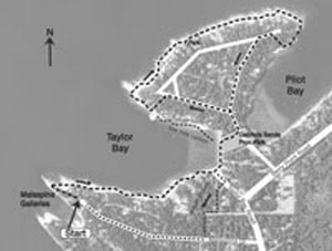
TAYLOR BAY SHORLINE WALK
by John Gambrill
I like a walk that tweaks my curiosity in some way. This walk takes you around Taylor Bay and the Decourcy headland, along some of the finest, accessible shoreline on BC’s Gulf Islands. Along the way there is plenty to tweak your curiosity, and for starters …Who is Taylor Bay named after?
I started with June Harrison’s book “The People of Gabriola”, and June has a wonderful account of George W. Taylor who was born in England in 1854. As a young man he visited a relative on Vancouver Island, liked what he saw and stayed. George was trained as a mining engineer in England, but became a clergyman in Victoria, and married the church organist. He became a rector in Nanaimo, and a valued member of the community. Tragedy struck in 1895, when his wife died shortly after the birth of their 4th child. Rev. Taylor was set to return to England, where family could help with raising his children. Nanaimo did not want to lose him, and offered the reverend a 100 acre parcel of land on nearby Gabriola Island for $1, if he would stay. This property contained a parcel that is now Gabriola Sands Provincial Park — what a deal for $1 !!
Soon after, Rev. Taylor and his children moved to an existing
|
|
|
Page 3
|
|
2-room homestead located by a sheltered sandy bay on the property. This bay is now called Taylor Bay, and the bush trail that his children walked to and from their schoolhouse at the junction of North Road and South Road is probably the route of today’s Taylor Bay Road. Rev. Taylor had a great interest in natural history, and he was instrumental in lobbying for and establishing the Biological Station at Departure Bay, Nanaimo. He was the Station’s first curator from 1908 until his death in 1912.
Our Taylor Bay shoreline walk is best from mid-Spring to mid-Fall. At other times of the year the sandstone shelf is very slippery, because of seaweed and algae that grow on the rock surface in the shady, moist conditions of winter. Also, summer is the best season on Gabriola Island for low, low tides in the daytime. Why is that? And while we are at it, why do we rarely see a sandy beach in the daytime during December/January? More curiosity stuff, and I’m afraid it would take too long to explain it now. Take a look at Nick Doe’s article in Shale magazine (Issue #6, April 2003).
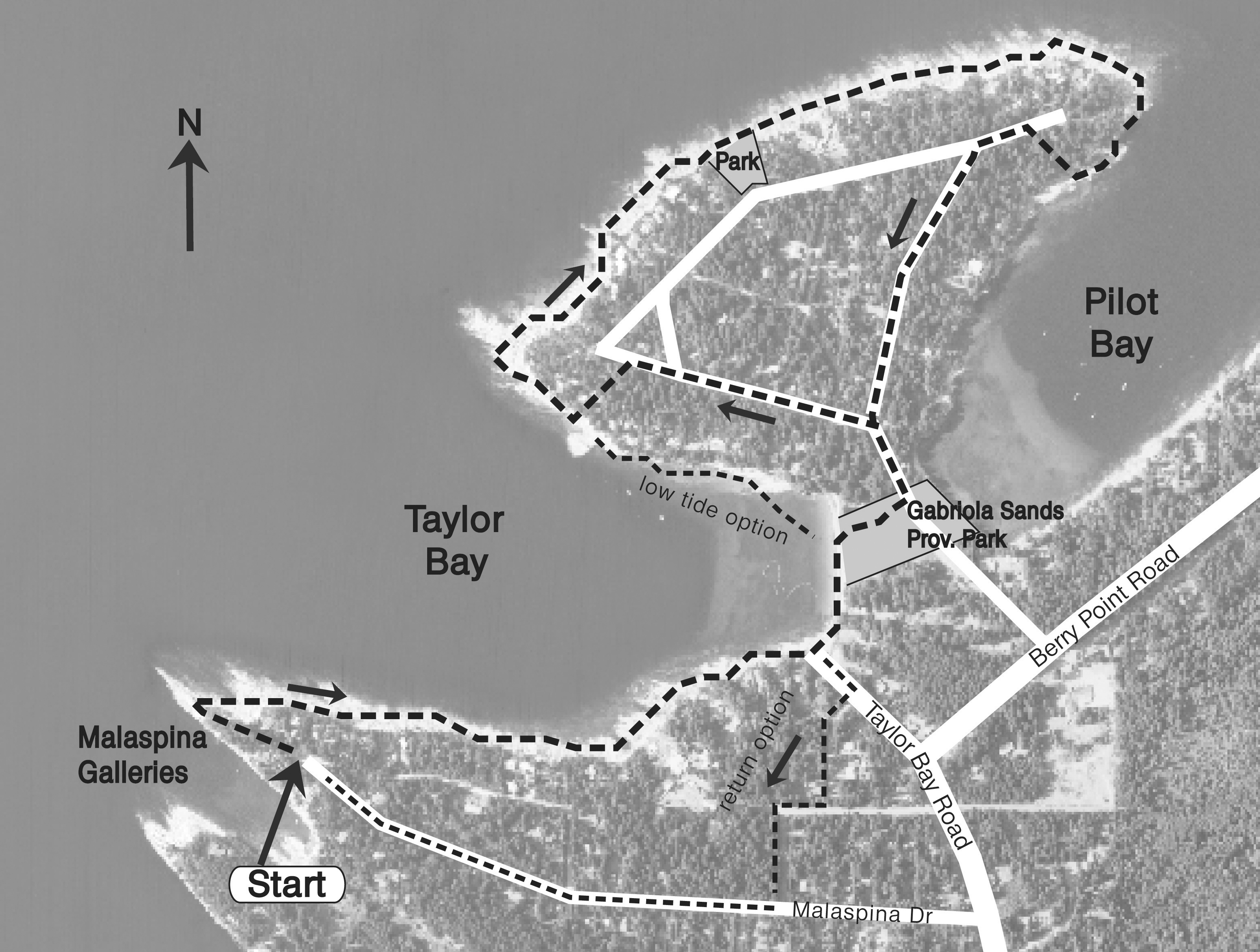
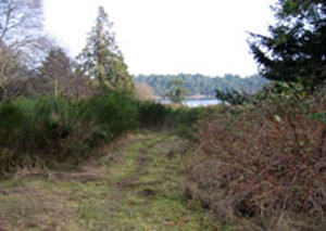
It’s time to walk. Park at the end of Malaspina Drive and take the short trail through the trees to the headland. Malaspina Galleries is to your left, and it’s always worth taking a look at this hooded sandstone ledge sculpted by the elements. Return to the headland, and to your right follow the sandstone shelf that stretches along the entire southern shoreline of Taylor Bay. There are always rock pools and interesting rock formations to explore. Just before you reach the sandy beach at the head of Taylor Bay, look to your right for a beach access (a couple of upturned rowboats mark the spot). This is the beach access to Taylor Bay Road, and is detailed later as a alternative return route in case the tide is too high.
If the tide is low you can walk along the sand around the bay and take the low-tide option as shown on the map. Otherwise, follow the map route across the grassy field behind the beach, turn left on the road, and take the left fork at the top of the slope.
Close to the end of the straight stretch of road look for a yellow beach access marker (between house #314 and #308). Follow the trail and steps down to the sandstone shelf. This area is a popular
|
swimming spot (sheltered waters, lots of warm rocks to dry-off on). After a swim (not mandatory!) you leave Taylor Bay and continue around the headland to the vista of the open waters of the Straight of Georgia, with mountains beyond. On a clear day you can see way, way up Vancouver Island to the NW, picking out the snowy peaks in Strathcona Park, then across the Straight of Georgia you can see Lasqueti Island, the peaky mountain outline of Texada Island, and finally the snow capped coastal mountains beyond Jervis Inlet. Quite the vista, and be sure to return to this spot for lovely sunset views. Further along this section of the sandstone shelf, look behind the beach for a densely forested piece of property. There is a yellow beach access marker at the top of the bank, and for your future reference this property is an undeveloped community park. Continue along the sandstone shelf until you round the headland, and then follow the shelf back towards Pilot Bay. This is another name that tweaks the curiosity. I believe the Port of Nanaimo, in the heyday of shipping coal and sandstone blocks, stationed two or more marine pilots on Gabriola. They would row out from Pilot Bay to guide ships in and out of Nanaimo Harbour. The shoreline into Pilot Bay soon becomes too rocky to continue on. About 100 m past the last headland is a small cove with several stairways coming down to the sandstone shelf. Look for the stairway with the yellow marker, and take this public beach access to the road. Turn left onto the road, take the next left fork and this road leads to the slope back down to Gabriola Sands Provincial Park. Cross the meadow back to the beach at Taylor Bay, and retrace your steps along the sandstone ledge to Malaspina Galleries.
If it is getting late in the day and the tide is rising fast, there is an alternative way back to your transportation. At the south end of Taylor Bay beach, walk up the bank at the Taylor Bay Road beach access. From Taylor Bay Road, turn right onto Maudie Miller Rd. and at the end, by the rock, you join Davis Road. Turn right on Davis, then left onto Harwood Road, which joins Malaspina Drive. Turn right on Malaspina and walk to the end where your transport awaits you.
The Rev. Taylor tweaked my curiosity on this walk, so I came home and Googled his name, and this is what I found in The Future of Fisheries Science in North America, by R.J. Beamish, B.J. Rothschild, published by Springer 2009:
“The Pacific Biological Station was established in 1908, in Nanaimo on Vancouver Island. Its first curator was the Reverend George Taylor, a self-taught field naturalist who lobbied the Canadian government to adopt a scientific approach in the study
|
and regulation of fisheries. His insistence on scientific rigor, applied problem solving, and peer-reviewed publications helped the station establish a world-class reputation for fisheries research.”
The Rev. Taylor is my Hero of the Month. I hope this walk tweaked your curiosity.
P.S. Before anyone puts a plaque up on Taylor Bay, further reading has turned up another 19th century Taylor family who may have claim to the name of the bay — I didn’t bargain on this when I set out on my shoreline walk!
MEMBERSHIP RENEWAL SEASON
Now is the time, after the Christmas season and before the tax return season, to renew your membership with GaLTT. In 2008, GaLTT had 155 paid-up members and to date in 2009, there are 65 paid-up memberships. GaLTT depends on membership funds to keep the organization operational — to pay for trail building materials and survey work, to pay liability insurance for the protection of our volunteers and to cover expenses like postage and printing. We know there are many demands on your community-giving dollars and we know that these are tough financial times. So what are the advantages of your GaLTT membership? You belong to a hard-working group of volunteers who are determined to open and maintain public trails for beach access, to join neighbourhoods and to connect Descanso to Drumbeg with a system of trails and park spaces. You belong to a group that is working to eradicate broom and other invasive plant species on Gabriola. You belong to an organization that provides opportunities for public education on environmental issues and for information about enjoying the natural world around us. This year GaLTT will sponsor edible mushroom and edible wild berry identification walks, and a hands-on oyster harvesting session. There will be a broom bashing session at Drumbeg Park on Earth Day along with information about how to most successfully eradicate broom on your own property. And, as a GaLTT member, you can borrow heavy-duty extractors to assist you in removing broom! We appreciate those of you who have supported GaLTT with your membership in previous years and ask that you both renew your membership for 2009, and reach out to someone else on the island — friends, neighbours — and invite them to join you in a GaLTT membership. Together we can make more good things happen.
Membership forms can be downloaded from the GaLTT website at www.galtt.ca. Family memberships are $25, individuals $20.
|
|
|
Page 4
|
Annual Report continued from page 1..
enrolls a new member. Talk to your friends and acquaintances, direct them to the website www.galtt.ca where they can download a membership form, and tell them what we are doing. The membership’s importance to this organization cannot be over-estimated.
On that note, thank you for coming out to the AGM. A copy of this report is available on the website.
Respectfully submitted,
Dyan Dunsmoor-Farley, President
BICYCLES AND TRAILS IN SPAIN
by Tom Cameron
The Route of Don Quixote of La Mancha
Our home exchange to Spain last fall landed us in Mascaraque, a small village south of Madrid and close to Toledo. This is in La Mancha which is the arid, elevated plain of central Spain. It seemed that everywhere we went we intersected the Ruta de Don Quixote. The development of this network of trails originated as part of the celebration of the 4th Centenary of the publication of El Ingenioso Hidalgo Don Quijote de La Mancha. The trails explore the natural settings where Cervantes sited the adventures of his fictional knight and faithful squire. The Ruta de Don Quixote is billed as the longest ecotourism corridor in Europe. The total itinerary is divided into 10 sections composed of 60 day-long outings. It touches 144 towns and covers a total of 2000 km. From Mascaraque, we rode one small leg on bikes to visit a medieval fortress, a hermitage and a ridge with a series of modern windmills; on another day we visited the historic windmills at Consuegra. These routes might prove a challenge at midday in the heat of summer. For more information consult the website at:
www.donquijotedelamancha2005. com
CYCLING IN SEVILLE
We never did get into the great cultural sites of Seville, partly it was Monday closings and the siesta schedule but really it was just too enjoyable being outside wandering and pedaling through this beautiful Andalucian city. What a treat to hop on and off the modern tramcar that snakes through the no-traffic zone of the Avenue of the Constitution.
|
After a month of travelling in Spain, this was the first city that was obviously physically active. Joggers on the boulevards, kayaks on the Rio Guadalquivir, and cyclists everywhere. The high tech municipal bike system is a joy. There are 2000 bikes at stations spread out across the city at about 200 meter intervals. Each station has an access terminal to purchase short or long term subscriptions and has parking points to dock the bikes. I must say I was a little nervous plugging my VISA card into the terminal to make a deposit and to get an interactive subscription ticket. One way or another, it never cost us a cent. We had a lot of fun riding the marked bike routes along the sidewalks of the city and cycling by the Expo 92 site on the Isla de la Cartuja. To find out more about the system and take a look at the very practical bikes visit the website at http://en.sevici.es/ Connected to this site there is a great article on the benefits of cycling titled, “The Bicycle: A Medicine Wheel”.
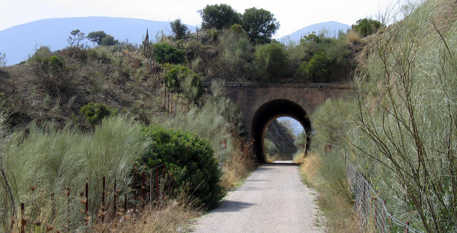
RAILS-TO-TRAILS IN SPAN AND VANCOUVER ISLAND
Vias Verdes refers to the more than 70 greenways totaling more than 1000 km that have been developed on unused railways. Shortly into our planned week in Olvera, a ‘white town’ by Ronda in southern Spain, we decided to book another week through Russell Kilde our Gabriolan host. The easy access to the Via Verde de la Sierra from Olvera was part of our decision to extend our visit. Along its 36 km course, this green- way boasts 30 tunnels, 4 trestles, and 5 railway stations. Some stations have been restored as hotels with services related to trail use. One day we walked west from Olvera along the greenway through the largely agricultural landscape, and on another day we rented bicycles at Coripe and further explored the busy trail and associated facilities. One station has an interpretative centre focused on the nature preserve surrounding the Penon de Zaframagon (a gigantic rocky crag) that has a large nesting colony of griffon vultures. The on-demand tunnel lighting is sometimes powered by solar panels and mini wind turbines. Once again we were amazed at the high quality of Spanish infrastructure and the emphasis given to heritage conservation and interpretation.

"Windmills for Don Quixote"
|
http://www.grazalemaguide.com/
places-tovisit/111-via-verde-de-la-sierra.htm
Closer to home we are blessed with great greenway trails. The Trails BC website is a starting point for additional information on trails in Nanaimo, the RDN and Vancouver Island.
http://www.trailsbc.ca/
v_island_region/index.html
707 ACRE COMMUNITY PARK MANAGEMENT PLAN
The terms of reference are ready, the contract consultant has been hired, and the community representatives to the steering committee have been selected. The first management plan for the community park will guide the operations, development, and stewardship of the property based on a comprehensive analysis of property values, and public and stakeholder consultations. The plan will confirm the long-term vision and goals for 707 Acre Community Park and identify shorter term management policies and actions for the period 2010-2020. The plan is to be reviewed after five years (2015) by a management steering committee and updated formally at ten-year intervals. The detailed terms of reference for the process can be found on the RDN website: http://www.rdn.bc.ca/cms.asp?wpID=1885
PARKS AND OPEN SPACE ADVISORY COMMITTEE (POSAC)
The POSAC Committee for Electoral Area 'B' (Gabriola Island, Mudge Island, DeCourcy Island) will soon be reactivated. Please watch for an announcement to recruit community representatives. The role of this Committee is to advise the Regional Board on matters that pertain to Regional District of Nanaimo Electoral Area 'B' Community Parks and Trails.
FARMERS' MARKET:
GaLTT will once again have a table at the Farmers’ Market. Make sure to stop by — organizer Barb Hague is planning some new items and this may be your last chance to pick up some GaLTT clothing! Check the dates in the local papers for the Market times. We’ll be there all summer.
TRAIL MAPS:
GaLTT is preparing to print more maps and we’re asking you to give us feedback on any errors or omissions you’ve spotted on the current edition. Please email your comments to info@galtt.ca
|
|
|
|